Our systems are now restored following recent technical disruption, and we’re working hard to catch up on publishing. We apologise for the inconvenience caused. Find out more

Recommended product

Popular links

Popular links


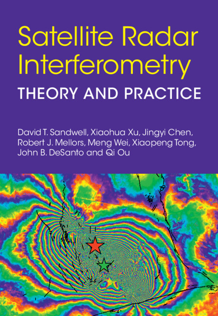
Satellite Radar Interferometry

Satellite Radar Interferometry
Open Access

Satellite Radar Interferometry

Theory and Practice
Authors:
David T. Sandwell, Scripps Institution of Oceanography, University of California, San Diego
Xiaohua Xu, University of Science and Technology of China
Jingyi Chen, University of Texas at Austin
Robert J. Mellors, Scripps Institution of Oceanography, University of California, San Diego
Meng Wei, University of Rhode Island
Xiaopeng Tong, Institute of Geophysics, China Earthquake Administration
John B. DeSanto, University of Washington
Qi Ou, University of Edinburgh
Published:
July 2025
Availability:
Not yet published - available from July 2025
Format:
Hardback
ISBN:
9781009606233

Looking for an examination copy?

This title is not currently available for examination. However, if you are interested in the title for your course we can consider offering an examination copy. To register your interest please contact [email protected] providing details of the course you are teaching.

    Synthetic Aperture Radar Interferometry (InSAR) is an active remote sensing method that uses repeated radar scans of the Earth's solid surface to measure relative deformation at centimeter precision over a wide swath. It has revolutionized our understanding of the earthquake cycle, volcanic eruptions, landslides, glacier flow, ice grounding lines, ground fluid injection/withdrawal, underground nuclear tests, and other applications requiring high spatial resolution measurements of ground deformation. This book examines the theory behind and the applications of InSAR for measuring surface deformation. The most recent generation of InSAR satellites have transformed the method from investigating 10's to 100's of SAR images to processing 1000's and 10,000's of images using a wide range of computer facilities. This book is intended for students and researchers in the physical sciences, particularly for those working in geophysics, natural hazards, space geodesy, and remote sensing. This title is also available as Open Access on Cambridge Core.

    • Includes exercises for students at the end of each chapter, along with their solutions
    • Documents the mathematical algorithms used in the GMTSAR processing package
    • Offers the open-source, GMTSAR software package to process data from the latest InSAR satellites for research and applications
    • This title is also available as Open Access on Cambridge Core

    Product details

    July 2025
    Adobe eBook Reader
    9781009606202
    0 pages
    Not yet published - available from July 2025

    Table of Contents

    • Preface and acknowledgements
    • 1. Introduction
    • 2 Principles of synthetic aperture radar
    • 3. Satellite orbits
    • 4. SAR image formation
    • 5. Interferometric processing
    • 6. Coherence, filtering, and phase gradient
    • 7. Phase unwrapping
    • 8. SAR modes
    • 9. Troposphere, ionosphere, and tide corrections
    • 10. Complementary approaches and time series
    • 11. Integration of InSAR and GNSS
    • Bibliography
    • Index.
    Resources for
    Type
    CH03
    Size: 3.48 MB
    Type: application/vnd.openxmlformats-officedocument.presentationml.presentation
    CH11
    Size: 44.47 MB
    Type: application/vnd.openxmlformats-officedocument.presentationml.presentation
    CH04
    Size: 6.31 MB
    Type: application/vnd.openxmlformats-officedocument.presentationml.presentation
    CH05
    Size: 3.27 MB
    Type: application/vnd.openxmlformats-officedocument.presentationml.presentation
    CH06
    Size: 69.46 MB
    Type: application/vnd.openxmlformats-officedocument.presentationml.presentation
    CH07
    Size: 28.22 MB
    Type: application/vnd.openxmlformats-officedocument.presentationml.presentation
    CH08
    Size: 32.85 MB
    Type: application/vnd.openxmlformats-officedocument.presentationml.presentation
    CH01
    Size: 547.48 KB
    Type: application/vnd.openxmlformats-officedocument.presentationml.presentation
    CH09
    Size: 62.76 MB
    Type: application/vnd.openxmlformats-officedocument.presentationml.presentation
    CH02
    Size: 2.48 MB
    Type: application/vnd.openxmlformats-officedocument.presentationml.presentation
    CH10
    Size: 22.7 MB
    Type: application/vnd.openxmlformats-officedocument.presentationml.presentation
      Authors
    • David T. Sandwell , Scripps Institution of Oceanography, University of California, San Diego

      David T. Sandwell is a Professor of Geophysics at Scripps Institution of Oceanography. His research is focused on marine tectonics, geodynamics, and the earthquake cycle using InSAR and GNSS (Global Navigation Satellite System). He is the author of more than 200 research papers and the book Advanced Geodynamics: The Fourier Transform Method (2022, Cambridge University Press). He is a member of the US National Academy of Sciences.

    • Xiaohua Xu , University of Science and Technology of China

      Xiaohua Xu is a Professor at the University of Science and Technology of China. His research is focused on earthquakes, faulting, crustal deformation, and tectonic geodesy.

    • Jingyi Chen , University of Texas at Austin

      Jingyi Ann Chen is an Associate Professor of Aerospace Engineering at the University of Texas at Austin. Her research is focused on the development of InSAR techniques for studying natural and induced seismicity, groundwater resources, natural disasters, and permafrost hydrology. She is a senior member of the Institute of Electrical and Electronics Engineers (IEEE) and a member of the American Geophysical Union (AGU).

    • Robert J. Mellors , Scripps Institution of Oceanography, University of California, San Diego

      Robert J. Mellors is a Researcher at Scripps Institution of Oceanography. His research is focused on enhancing geophysical sensing including InSAR, global seismic instrumentation, muons, and photonic seismology. He is currently an advisor to the US Department of Energy (ARPA-E) on advanced energy technologies.

    • Meng Wei , University of Rhode Island

      Meng (Matt) Wei is an Associate Professor of oceanography in the Graduate School of Oceanography at the University of Rhode Island. His research is focused on tectonic geodesy, fault mechanics, coastal subsidence, and natural hazards. He has published about thirty research papers and is a recipient of a Faculty Early Career Development Program (CAREER) award from the National Science Foundation .

    • Xiaopeng Tong , Institute of Geophysics, China Earthquake Administration

      Xiaopeng Tong is an Associate Researcher in the Institute of Geophysics, China Earthquake Administration, Beijing. He Ph.D. is from the Scripps Institution of Oceanography, University of California, San Diego. His research interests include InSAR, space geodesy, and crustal deformation.

    • John B. DeSanto , University of Washington

      John B. DeSanto is a Research Scientist at the University of Washington. His primary interests lie in the fields of marine tectonics and subduction zone processes. He studies these regions directly by adapting geodetic techniques such as GNSS to the offshore environment.

    • Qi Ou , University of Edinburgh

      Qi Ou is a Lecturer at the University of Edinburgh. She applies big Earth Observation data to understand multi-hazards induced by active tectonics, climate change, and anthropogenic activities. She is author of several highly cited papers, convener and speaker at the Seismological Society of America and American Geophysical Society conferences, and recipient of a Discipline Hopping Award from UK Research and Innovation (UKRI).